|
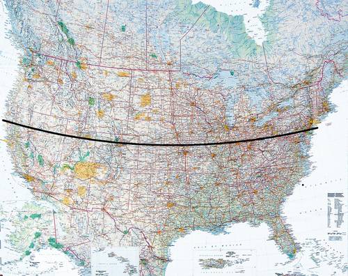
With the help of the Global Positioning System in July and August 2001 soil was collected following an exact line which corresponding to the 40th degree of latitude North, thus encompassing the geographical center point of the USA.
The sites on this line will be determined by the intersection of the full degrees of longitude. This results in 50 sites between 75° and 124° West, since the distance between two degrees of longitude is about 85 kilometers. The circumstances during this time made possible an approach of about 300 meters to the excavation sites.
At each site a photo was taken looking West.
| |
The work is a symbol for a way, leading from East to West, like the settlement of the white people in North America.
The GPS, a very modern technology, having been developed in the USA, made possible to realize the project in a very short time.
The line runs along geographically determined sites, which have all a concrete historical background. These can be judged subjectively and in a very different manner.
The Earth Art Works are an objective picture of these sites.
|

